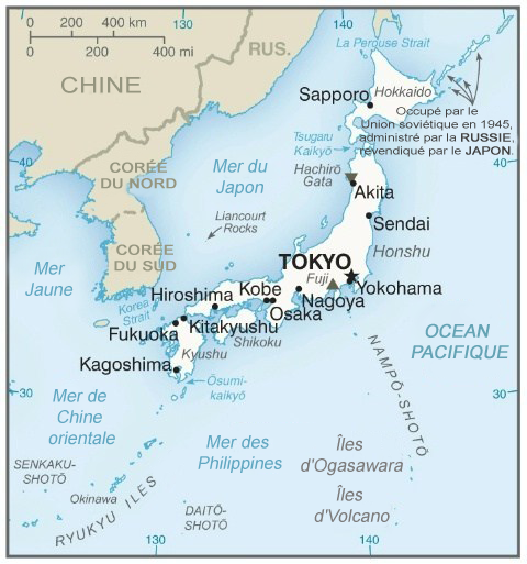
File:Cartedujapon.png
Appearance
Cartedujapon.png (480 × 513 pixels, weyninka faylka : 240 KB, nuuca MIME: image/png)
Taariikhda faylka
Riix taariikhda/waqtiga si aad u argto faylka sida oo ahaa markiisa hore.
| Taariikhda/Waqtiga | Sawir yar | Cabirka | Isticmaale | Ka hadalka | |
|---|---|---|---|---|---|
| kan hadda | 06:17, 7 Febraayo 2020 |  | 480 × 513 (240 KB) | Artanisen | Carte plus récente du Japon. Fabriqué par la CIA. Source: https://www.cia.gov/library/publications/the-world-factbook/geos/ja.html |
| 06:26, 22 Luuliyo ama Luulyo 2014 |  | 351 × 377 (93 KB) | Simba Hekima | a écrit le nom de la mer en détail | |
| 14:45, 29 Sebteembar 2006 |  | 351 × 377 (78 KB) | Loveless | This image was copied from wikipedia:fr. The original description was: '''Titre:''' carte du japon (en français)<br /> '''Licence:''' {{DomainePublic}}<br /> '''Source:''' provenant du fr:CIA World Factbook fr:Catégorie:Cartes du Japon {| b |
Faylka lagu isticmaalay
waxyaabaha soo socda ee bog ayaa adeegsanaya faylkaan:
isticmaalka faylka aduunka
Wikisyada kale ee soosocda ayaa adeegsanaya faylka:
- Ku isticmaal fr.wikipedia.org
- Japon
- Mer du Japon
- Portail:Japon/temporaire
- Portail:Japon/Article de la semaine archive
- Utilisateur:Eden2004/Portail Japon base
- Utilisateur:Eden2004/Portail Japon
- Utilisateur:Eden2004/Portail Japon/Portail Japon Nature
- Utilisateur:Eden2004/Portail Japon/Portail Japon Histoire
- Utilisateur:Eden2004/Portail Japon/Portail Japon Arts
- Portail:Japon
- Utilisateur:Settychea/Livres/Le japon
- Utilisateur:Kohfuku/Brouillon
- Portail:Japon/Géographie
- Ku isticmaal gcr.wikipedia.org
- Ku isticmaal ht.wikipedia.org
- Ku isticmaal nrm.wikipedia.org


