Jump to content

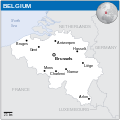
File:Belgium - Location Map (2013) - BEL - UNOCHA.svg

Page contents not supported in other languages.
Ka Wikipedia

Faylka asalka ah (SVG file, nominally 254 × 254 pixels, file size: 909 KB)

Render this image in .

Faylkaan wuxuu ka socdaa Wikimedia Commons waxaana adeegsan kara mashaariic kale. Sharaxaadda ku taal boggeeda faylka ee bogga sharaxaadda faylka halkan hoose ayaa lagu muujiyey.

Qoraal kooban

Sharaxaad
English: Locator map of Belgium.
Taariikhda
Xigasho
English: Belgium Locator Map (ReliefWeb), ESRI, UNCS
Qoraa
SVG genesis
InfoField
 
The SVG code is valid.
 
This map was created with Inkscape.
 
 This map uses embedded text that can be easily translated using a text editor.


Laysinka

w:en:Creative Commons
Astaan
This file is licensed under the Creative Commons Attribution 3.0 Unported license.
Attribution: OCHA
Waad fasaxantahay:
  • la wadaagid – koobi gareenta, qaybinta iyo gudbinta shaqada
  • to remix – in shaqada la waafajiyo
Shuruudaha soo socda:
  • Astaan – You must give appropriate credit, provide a link to the license, and indicate if changes were made. You may do so in any reasonable manner, but not in any way that suggests the licensor endorses you or your use.
This map is part of a collection of 216 free country maps, created by the UN Office for the Coordination of Humanitarian Affairs (OCHA), to be used in print, web or broadcast products.

The ReliefWeb Location Maps released here are maps that highlight a country, its capital, major populated places and the surrounding regions.

Attribution Requirements

Using the map without modifications: ensure that the sources and the disclaimer are below the map. Credit as follows: "Credit: OCHA".

For use with alteration: remove the OCHA logo and disclaimer following any modification to the map, but keep the data sources as mentioned below the map. Credit the modified map as follows: "Based on OCHA map". You are responsible for the content of your map.

We are keen to receive your feedback and hear how you used OCHA's maps. We would be grateful if you would notify us by e-mail and share your work with us.

UN Disclaimer
The designations employed and the presentation of material of this map do not imply the expression of any opinion whatsoever on the part of the Secretariat of the United Nations concerning the legal status of any country, territory, city or area or of its authorities or concerning the delimitation of its frontiers or boundaries.
VRT Wikimedia

This work is free and may be used by anyone for any purpose. If you wish to use this content, you do not need to request permission as long as you follow any licensing requirements mentioned on this page.

The Wikimedia Foundation has received an e-mail confirming that the copyright holder has approved publication under the terms mentioned on this page. This correspondence has been reviewed by a Volunteer Response Team (VRT) member and stored in our permission archive. The correspondence is available to trusted volunteers as ticket #2014031410007248.

If you have questions about the archived correspondence, please use the VRT noticeboard. Ticket link: https://ticket.wikimedia.org/otrs/index.pl?Action=AgentTicketZoom&TicketNumber=2014031410007248
Find other files from the same ticket: SDC query (SPARQL)

Captions

Add a one-line explanation of what this file represents

Items portrayed in this file

depicts Ingiriisi

copyright status Ingiriisi

copyrighted Ingiriisi

inception Ingiriisi

2013

media type Ingiriisi

image/svg+xml

checksum Ingiriisi

bef791a3c5cc4705acf6a960594056c6b2645592

data size Ingiriisi

925,787 byte

height Ingiriisi

254 pixel

width Ingiriisi

254 pixel

Taariikhda faylka

Riix taariikhda/waqtiga si aad u argto faylka sida oo ahaa markiisa hore.

Taariikhda/WaqtigaSawir yarCabirkaIsticmaaleKa hadalka
kan hadda20:51, 2 Juun 2024Sawirka yar nuuciisa ahaa 20:51, 2 Juun 2024254 × 254 (909 KB)J4keeS237File uploaded using svgtranslate tool (https://svgtranslate.toolforge.org/). Added translation for ka.
17:21, 4 Febraayo 2024Sawirka yar nuuciisa ahaa 17:21, 4 Febraayo 2024254 × 254 (905 KB)IllchyFile uploaded using svgtranslate tool (https://svgtranslate.toolforge.org/). Added translation for id.
19:33, 7 Nofeembar 2014Sawirka yar nuuciisa ahaa 19:33, 7 Nofeembar 2014254 × 254 (904 KB)GermanJoewatermark removed
22:26, 13 Maaj 2014Sawirka yar nuuciisa ahaa 22:26, 13 Maaj 2014254 × 254 (948 KB)UN OCHA maps bot== {{int:filedesc}} == {{Information |description={{en|1=Locator Map of Belgium. {{OCHA map}}}} |date=2013 |source=[http://reliefweb.int/map/belgium/belgium-location-map-2013 Belgium Locator Map (ReliefWeb)] |author=[[w:United Nations Off...

waxyaabaha soo socda ee bog ayaa adeegsanaya faylkaan:

isticmaalka faylka aduunka

Wikisyada kale ee soosocda ayaa adeegsanaya faylka:

Metadata